
Research Resources
Are you researching a person from or a topic in Marion County, Oregon? In addition to materials you might find here at the Willamette Heritage Center, here is a list of online and community resources for researching community history in Marion County. Also, don’t forget to check out our FAQ page here.
Incorporated Communities
Unincorporated Areas
Post Offices, election precincts, unincorporated communities and ghost towns
Established December 18, 1888 with Levi Hollister as first postmaster; discontinued September 3, 1902; reopened in 1911 as West Stayton. (Payne, Edwin “Marion County Post Offices.” Marion County History Volume 1, 1955)
Post office established February 14, 1889, with Sallie Elgin as postmaster. On May 21, 1894, the office was moved a mile west and name changed to Sidney (Payne, Edwin “Marion County Post Offices.” Marion County History Volume 1, 1955).
Ankeny Bottom is defined as located “on the east bank of Willamette River just north of the mouth of the Santiam. It was named for Henry E. Ankeny, son of Captain A.P. Ankeny, who developed a farm there in the 1870s…Ankeny post office was at or near the Ankeny home on the northeast edge of Ankeny Bottom. It was established in February, 1889. The name of the office was changed to Sidney in May 1894 and moved to a new location. (McArthur, Lewis A. Oregon Geographic Place Names Oregon Historical Society, 1982).
Post Office established April 10, 1889 with George Lehamn as postmaster; discontinued September 30, 1904 with Herb Brown as last postmaster (Payne, Edwin “Marion County Post Offices.” Marion County History Volume 1, 1955).
Townsite was near Silver Creek about a dozen miles southeast and upstream from Silverton, very close to Silver Creek Falls. Argenti post office was established April, 1889, with Geroge A. Lehman first of six postmasters. The office was closed in September, 1904, with all papers to Sublimity. There is a local story in Silverton and in Salem to the effect that Herbert Hoover, then a resident of Salem, worked as a chainman on the survey party that laid out the original townsite. See Dean Collins’ story in the Oregon Journal 19 April 1940. It is said that there was a post office, store, blacksmith shop, hotel and two sawmills in the place, but these establishments have completely disappeared. Argenit is the Latin word meaning “of silver,” a name obviously suggested by Silver Creek nearby. (McArthur, Lewis A. Oregon Geographic Place Names Oregon Historical Society, 1982).
This is one of Oregon’s ghost towns, situated about a mile south of Woodburn ((McArthur, Lewis A. Oregon Geographic Place Names Oregon Historical Society, 1982).
Post office established June 15, 1860, with Joseph Engle as postmaster. It was by-passed by the railroad and the Post Office moved to Gervais on the railroad on November 6, 1871. (Payne, Edwin “Marion County Post Offices.” Marion County History Volume 1, 1955)
Read more about this community here.
Post Office established June 8, 1893 with Ira Hatfield as postmaster. Emma Berry was the last postmaster when it closed January 13, 1906. It was three miles west of Detroit. (Payne, Edwin “Marion County Post Offices.” Marion County History Volume 1, 1955)
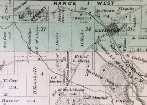
Berry was a station on North Santiam River a few miles southwest of Detroit. It was named for a family of early settlers on the river. Berry post office was established June 8, 1893, with Ira S. Hatfield first of four postmasters. The office was closed January 13, 1906 (McArthur, Lewis A. Oregon Geographic Place Names Oregon Historical Society, 1982).
Community west of Silverton, Oregon. Visible as platted town in 1878 Atlas of Marion and Linn Counties, Oregon.
Read more about this community here.
Bethany is a community about two miles west of Silverton on the road west to Chemawa…(McArthur, Lewis A. Oregon Geographic Place Names Oregon Historical Society, 1982).
Bethel School is on the south side of the penitentiary road about six miles east of the business section of Salem. In early days Dan Early operated a sawmill in this locality, cutting some of the fine timber that grew three. Soon after the mill was torn down a group of Dunkards settled in the place and built a church on the site of the mill. This they called the Bethel Church. The Dunkards* lived a quiet life there for some years but the group gradually dwindled to the point where the church could no longer be maintained. The building was sold to the newly formed Bethel school district, made up from the parts of other districts. The old building was used until about 1925, when a new school was built. There is more information about the name and place in a short neighborhood story by Mrs. J.R. Carruthers in the Salem Oregon Statesman, October 1, 1931. — McArthur, Lewis. Oregon Geographic Placenames. Oregon Historical Society, 1984.
*Dunkards refers to a religious organization affiliated with the Schwarzenau Brethren
Post office established March 21, 1928 with Merle Bruckman as postmaster; discontinued September 30, 1953.
Breitenbush post office and Breitenbush Hot Springs, on Breitenbush River about ten miles northeast and upstream from Detroit, got their names from the river…. (McArthur, Lewis A. Oregon Geographic Place Names Oregon Historical Society, 1982).
Post Office established November 18, 1919 with Ed. Trentor as postmaster; closed November 1, 1923. Cedar Camp post office opened here in 1932. (Payne, Edwin “Marion County Post Offices.” Marion County History Volume 1, 1955)
Bridge Creek is a stream southwest of Silverton, the waters of which find their way into Abiqua Cree, but the compiler does not know just how. He has been told that the stream was named in pioneer days because of a convenient bridge, but he does not know its location. Bridge Creek post office was established near this stream in November 1919, and operated until November 1923, when it was closed to Hullt. Edward Trenter was the only postmaster. This office was a little to the east of Hullt, near the north quatercorner of section 9, township 8 south, range 2 east. It was very close to the old Bridge Creek school and the two establishements were both named fro the stream. In 1932-33 a new post office called Cedar Camp was in service in the same location with Mrs. Edith M. Filer, postmaster. Cedar Camp was apparently named because of the cedar lumber and shingle making in the vicinity. (McArthur, Lewis A. Oregon Geographic Place Names Oregon Historical Society, 1982).
About the time the Oregon Electric was opened for service between Portland and Salem in 1908, a station with the descriptive name Broadacres was established at a point about three miles west of Hubbard. There was not a great deal of business there at first, but in a few years it was necessary to have a post office. This office called Broadacres was opened in June 1914 and was discontinued in December 1928 with the business turned over to Hubbard. John R. Foulds was the first postmaster. (McArthur, Lewis A. Oregon Geographic Place Names Oregon Historical Society, 1982).
Community Resources:
Brooks Historical Society and Museum at Antique Powerland
3995 Brooklake Rd NE, Salem, Oregon
Butteville is on the east bank of the Willamette River in the extreme north part of the county and has an elevation of 103 feet. It was named for a well-known hill about a mile to the southwest, called by the early settlers on French Prairie La Butte, a form of name still used by the USGS on its map of the Sherwood quadrangle, which shows the geography of this region….(McArthur, Lewis A. Oregon Geographic Place Names Oregon Historical Society, 1982).
Read more about this community here.
Cedar Camp post office was established November 26, 1932, and operated until July 22, 1933. Mrs. Edith M. Filer was the only postmaster. This office was a little to the northeast of Hullt and in the same locality as the older Bridge Creek Post office. Cedar Camp was so known because there were several cedar shingle camps in the vicinity. Cedar Camp appears to be a name synonymous with the Bridge Creek locality. The compiler has been told that Cedar Creek is another name for Bridge Creek, but he cannot find any official sanction for the name Cedar Creek as applied to the stream. — McArthur, Lewis. Oregon Geographic Place Names. Oregon Historical Society, 1984 pg 140.
Champoeg established July 10, 1851, with Robert Newell as postmaster. The flood of late 1861 left only one store. The post office was inactive from 1862-1864, and was officially closed August 2, 1864. Champoeg was established May 2, 1880, with Byron Clark as postmaster and closed August 18, 1901, due to rural free delivery. It was formerly Newellville from 1864-1880, but the old name was restored. –Payne, Edwin R.”Marion County Post-Offices” Marion County History Volume 1, 1955
The name Champoag (Champooick in early official records of the provisional government) is variously explained. According to F.X. Matthieu, the name was derived from the French word Campment du Sable, “camp of sand” (OHQ volume I, page 88). According to other testimony, the origin is from French champ (“field”) and an Indian word, probably pooich (“root”); or the word may be purely Indian, designating a root or a weed. According to H.S. Lyman, the name is not French, but of Indian orgin; Cham (hard ch), as in Chehalem, Chenamus, Chemeketa, Calapooya, OHQ, volume I, page 176. Frederick V. Holman says Champoeg is an Indian word, Champoo, a weed, (ibid., volume XI, pages 22-23). Wilkes’ map of 1841 shows Champooing. Champoeg was the site of the first warehouse of the Hudson’s Bay Company on the Willamette River, south of Oregon City, and the shipping place of wheat of the Willamette Valley. The accessibility of Champoeg by land and water caused it to be chosen as the meeting place to consider a provisional government. The site of the Champoeg meeting place and monument is on the south bank of the Willamette River about midway between Newberg and Butteville. The settlement of Champoeg is about half mile to the south on Mission Creek. Events leading up to the Champoeg meeting of May 2, 1843, are set forth in Scott’s History of the Oregon Country, volume II, page 3, where beings Harvey W. Scott’s address on the occasion of the unveiling of the Champoeg Monument on May 2, 1901. On February 15, 1841, Ewing Young died at a point not far from the present site of Newberg and as he left considerable preopty and no heirs, the necessity of a civil government was manifest. Some little headway toward securing a government was made, but it was not until two years later that the movement acquired enough momentum to amount to anything. Two preliminary meetings were held in the spring of 1843, at the second of which a committee was appointed, and this committee was to report at a meeting to be held at Champoeg May 2, 1843. At the appointed time about an equal number of American and British citizens met, and by a narrow margin, the Americans gained control of the situation and started the organization that developed into the provisional government of Oregon, the first government by Americans on the Pacific Coast. The site of Champoeg meeting is now owned by the state of Oregon, and is a public park… — McArthur, Lewis. Oregon Geographic Place Names. Oregon Historical Society, 1984
Resources
Champoeg State Heritage Area (website). Visitor Center has exhibits talking about history of the area.
Books:
Hussey, John A. Champoeg: Place of Transition. Oregon State Highway Commission, 1967. (Find at a library near you)
Chemawa is one of the Indian names in the state that has several fanciful meanings attributed to it, including “our old home,” true talk” and “gravelly soil.” There is little on record to substantiate any of the meanings. Silas B. Smith, Clatsop County pioneer, is authority for the statement that Chemay-way was the Indian name for a point on the Willamette River about two and a half miles south of Fairfield where Joseph Gervais settled in 1827-28. The same name was applied to Wapato Lake…Many Indian names begin with Che and Cham, particularly those applied to places in the Willamette Valley, such as Chemawa, Chehalem, Chemeketa, and Champoeg. For information on this matter see article by H.S. Lyman, Oregon Historical Quarterly Volume I, page 316. Chemawa has an elevation of 165 feet. —McArthur, Lewis. Oregon Geographic Place Names. Oregon Historical Society, 1984
The 1929 Metsker’s Map of Marion County (view on HistoricMapworks) shows Claxtar as located just northeast of the intersection of sections 1, 2, 11, 12 in Township 7 S, Range 3 West of the Willamette Meridian. The place is approximately where today’s Claxtar Rd intersects the Burlington Northern Santa Fe Railroad operated tracks (see Marion County Assessor’s Map 07 3W 01CC KEIZER).
Claxtar is one form of the name of the Tlatskanal Indian tribe, generally known as Clatskanie. For information about this tribe see Handbook of American Indians, volume II, page 763. When the Oregon Electric Railway was built officials used this name for a station north of Salem, adopting the spelling employed by Lewis and Clark. — McArthur, Lewis. Oregon Geographic Place Names. Oregon Historical Society, 1984 pg 160
Clymer post office, which operated with one break from May 1883 to May 1901, served an area a little to the southeast of Mccleay in the vicinity of McAlpin school. The office was named for the first postmaster Mary Clymer. — McArthur, Lewis. Oregon Geographic Place Names. Oregon Historical Society, 1984 page 163
This station on the Oregon Electric Railway about three miles southwest of Gervais was named for Chief Comcomly, head of the Chinook tribe, who is described in Irving’s Astoria and also in Alexander Henry’s journal. he died in 1830 and his grave was visited by Wilkes in 1841. For references to Chief Comcomly see Scott’s History of the Oregon Country volume II page 139. The spelling used by the railway company is a variation on the original name. Lewis and Clark met Comcomly on November 20, 1805, and gave him medals and a flag. Irving describes him in a decidedly humorous vein. His daughter married Archibald McDonald of the Hudson’s Bay Company and their son Ranald McDonald is an interesting figure in northwest history. Ranald McDonald 1824-1894, edited by Lewis and Murakami and published in 1923 by Eastern Washington State Historical Society contains much interesting information about Comcomly and his family, and also about McDonald’s visit to Japan in 1848-49, which is of great historic interest. An editorial in the Oregonian for November 29, 1893, treats of McDonald’s pretensions to the Chinook throne. — McArthur, Lewis. Oregon Geographic Place Names. Oregon Historical Society, 1984 pg 172.
Croston was the name of the post office on the east bank of Willamette River at the east landing in Halls Ferry. This landing was several miles down stream from Independence. The post office was established December 22, 1884, with Benjamin F. Hall first of three postmasters and continued in service until March 19, 1901. When it was established, Croston post office was put on the Polk County list, but this must have been in error, for there is nothing to indicate that it ever operated in Polk County. It is obvious that the name was intended to indicate a place where there was a crossing, in this case, a ferry. — McArthur, Lewis. Oregon Geographic Place Names. Oregon Historical Society, 1984 page 196.
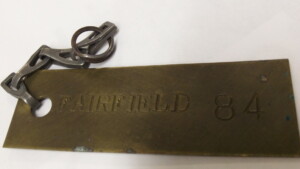
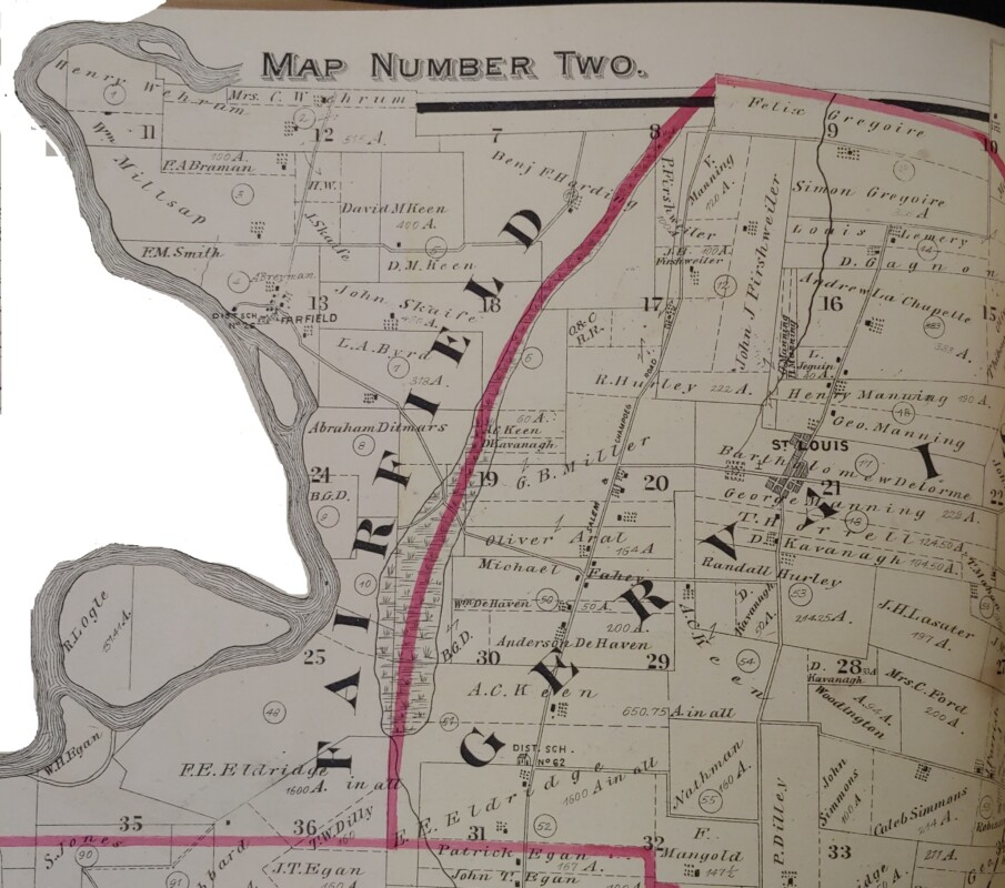
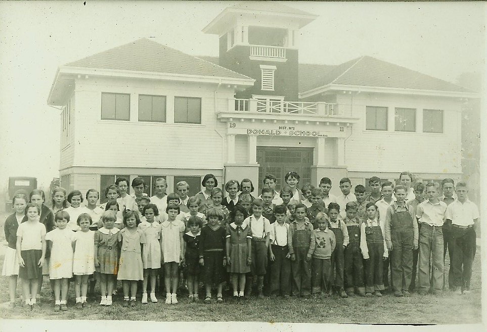
Election box tag for Fairfield, Oregon. Willamette Heritage Center Collections 2013.016.0002
Fairfield was a post office, steam boat landing, election and census precinct and community just northwest of St. Louis in Marion County, Oregon. Learn more about the community and see what materials are in the Willamette Heritage Center Collections here.
Area north and east of the original townsite of Salem and the location of the Oregon State Fairgrounds. Maintained a railroad station on the mainline of the Southern Pacific and a post office.
[Post Office] established December 1, 1871, with William Longhead as postmaster; inactive from 1874 to 1892, and closed September 30, 1914. — Payne, Edwin R.”Marion County Post-Offices” Marion County History Volume 1, 1955 page 16Community Resources
Champoeg State Heritage Area
8239 Champoeg Rd NE, Saint Paul, OR 97137
St. Paul Mission Historical Society
PO Box 158, St. Paul, Oregon
Community located east of Salem. The 1929 Metsker’s Map of Marion County (viewable on HistoricMapWorks website) shows the community located between sections 21 and 28, Township 7 South Range 2 West of the Willamette Meridian.
[Post Office] established September 5, 1892 with George Nichols as postmaster; discontinued March 19, 1901 due to rural free delivery from Salem. –Payne, Edwin R.”Marion County Post-Offices” Marion County History Volume 1, 1955 page 16.More Resources:
Accompanying Map shows location on east edge of Township 6 South, Range 2 West of the Willamette Meridian.
1929 Metsker’s Map of Marion County (viewable at HistoricMapWorks ) locates the community and school between sections 1 and 12 of Township 8 South Range 1 East of the Willamette Meridian.
[Post Office] established April 25, 1891 with C.J. Hullt as postmaster; discontinued July 31, 1943. Payne, Edwin R.”Marion County Post-Offices” Marion County History Volume 1, 1955 page 17.Liberty was an unincorporated community south of Salem with a post office and school district. It is now mostly subsumed by the city of Salem (reference Liberty School in South Salem which is now part of the Salem Keizer School District, but was the school in Liberty at the time). The 1929 Metsker’s Map (viewable on HistoricMapWorks) places the community center in Section 9, Township 8 South, Range 3 West of the Willamette Meridian.
[Post Office] established January 24, 1895 with J.R. Willard as postmaster; discontinued March 19, 1901 with the coming of rural free delivery. — Payne, Edwin R.” Marion County Post-Offices” Marion County History Volume 1, 1955 page 17.This incorporated community south of Turner along the Southern Pacific railway line. A post office was established here on January 9, 1871. A school district was created in the area as early as 1857.
In 2000, the community had an estimated 214 people, although one resident noted that they had “a Turner mailing address, a Stayton phone number and we’re in the Jefferson Fire District.” (Akimoff, Timothy Alex. “At a Fork in the Road.” Statesman Journal. 8 May 2006.)
The Oregon Geographic Place Names (5th edition, 1982) by Lewis McArthur gives an entertaining description of its founding, claiming that a folks just ran with it when depot materials intended for a station at the current location of Turner were wrongly delivered too far south. When the mistake was realized a new depot with a new name was established at Turner.
Read more:
“History of Marion, Oregon” by Margaret Davidson
“History of Marion Grade School” by Linda (Smith) McLaughlin
1929 Metskers Map of Marion County (viewable on HistoricalMapWorks) locates the community in Section 28, Township 5 South, Range 1 West of the Willamette Meridian.
[Post Office] established March 12, 1888 with David McKee as postmaster; discontinued June 14, 1924. — Payne, Edwin R. “Marion County Post-Offices” Marion County History Volume 1, 1955 page 17. Accompanying map locates McKee as northwest of Monitor, along the Southern Pacific Railroad line in Township 5 South, Range 1 West of the Willamette Meridian.Unincorporated, Census designated place located on Highway 22, Section 18, Township 9 South Range 2 East of the Willamette Meridian. Population in 2022 was 534 people.
[Post Office] established March 12, 1877 with John J. Blair as postmaster. — Payne, Edwin R. “Marion County Post-Offices” Marion County History Volume 1, 1955 page 17.Resources:
Stout, Ray L. “The Mehama Story” Marion County History Volume 10, 1969-1971
Monitor is an unincorporated community 3 miles northeast of Mount Angel.
[Post Office] established November 16, 1869 with John Eagon as postmaster and closed from 1904 to 1916 when it was reestablished. Changed to a rural station served from Woodburn on August 31, 1953. — Payne, Edwin R. “Marion County Post-Offices” Marion County History Volume 1, 1955 page 17Community located west of Gates, Oregon along the North Santiam River in Marion County. 1929 Metkser’s Map of Marion County (viewable on Historic Map Works website) identifies community location on North side of North Santiam River in section 29, Township 9 South, Range 4 East of the Willamette Meridian.
[Post Office] established October 3, 1890 with William Burns as postmaster; discontinued June 14, 1934. Payne, Edwin R. “Marion County Post-Offices” Marion County History Volume 1, 1955 page 20.Parkersville is a community that was located in the south half of Section 6, Township 6 South, Range 1 West of the Willamette Meridian, just northwest of Mount Angel and southeast of Gervais. The town appears listed in the 1878 Atlas of Marion and Linn Countys (view on Historic Map Works here)
[Post Office] established September 29, 1852, with F.E. Eldriedge as postmaster; closed December 2, 1862. — Payne, Edwin R. “Marion County Post-Offices” Marion County History Volume 1, 1955 page 20.Resources:
Collections:
Willamette Heritage Center Ledger
Publications:
Strozut, George, Jr. “William Parker and Parkersville” Marion County History Volume 2, 1956 pp 20-23
1929 Metsker’s Map for Marion County (viewable online at HistoricMapworks) shows Pratum as located along the Southern Pacific railroad line in section 13, Township 7 South, Range 2 West of the Willamette Meridian.
[Post Office] established as Enger in 1897, and changed the name to Pratum on October 1, 1898, with Mr. Larson continuing to serve as postmaster. The earlier office of Switzerland, established in 1887, was moved to the Enger office in 1897. On June 30, 1953, Pratum was changed to a rural station served by Salem. Payne, Edwin R.”Marion County Post-Offices” Marion County History Volume 1, 1955 page 20.A.K.A Livesley, A.K.A. Croston
This is the name for an unincorporated community southwest of the city of Salem along River Road, along the east bank of the Willamette River. It encompasses and area approximately between Halls Ferry to the south and Brown’s Island to the north. The history of this region is a bit fluid. Early Schools of Marion County (WHC X2011.001.0130) published by the Marion Intermediate Education District in 1976, states that a Marion County district school No. 48 was established on February 1, 1877. The 1878 Atlas of Marion and Linn Counties shows the school located on the south side of River Road, on a ridge, in the southwest quarter of section 6, Township 8 S, Range 3. The 1878 atlas also shows the Ferry Crossing, as what we now call Hall’s Ferry, listed as “Leabo Ferry.”
On December 22, 1884, a Post Office with the designation “Croston” was established at Hall’s Ferry (see Oregon Post Offices 1847-1982 by Richard W. Helbock, 1985, second revised edition, WHC 2011.035.0001). Helbock describes the post office as “located at a ferry crossing on the Willamette, about 8 miles south of Salem. Situated on the east bank of the river at a place called “Hall’s Ferry.” This post office was in operation until May 31, 1901. It is likely the name Croston persisted until the closure of the post office, if not beyond.[soundcloud url=”https://api.soundcloud.com/tracks/308309660″ params=”auto_play=false&hide_related=false&show_comments=true&show_user=true&show_reposts=false&visual=true” width=”100%” height=”450″ iframe=”true” /]
In 1911, the Oregon Electric Railway established lines south of Salem and named their station in the area “Livesely” after Thomas Albert Livesley, who with his partner John J. Roberts operated large tracts of hops in the region. In 1925, Roberts bought out his partner Livesley and the name of the station and the community changed to Roberts (see Oregon Geographic Names by Lewis McArthur, 1982, WHC 2006.040.0494).
The school seems to have followed the same naming trajectory. A March 23, 1951 Oregon Statesman article is titled “When Roberts School was Croston” and features a 1906 picture taken at the “Croston School.” It was also known as the Livesley and Roberts School respectively before it was closed in 1974 (see Alfred Jones “Roberts Goodbye is Sad.” Capital Journal June 6, 1974.)
WHC Resources:
Chambers, Doug. Illustrated Memoirs & History of the Livesley-Roberts Community 1840s-1940s. Self Published, 1997. Copy in the Library of the Willamette Heritage Center WHC 2006.040.0055
Claude Edwards Oral History (1968) with David Duniway and John Davis. WHC X2012.031.0037. Listen here.
The 1929 Metsker’s Map of Marion County (view at Historic Map Works site) locates the community on the southeast edge of section 11, Township 6 South, Range 1 West of the Willamette Merdidian.
[Post Office] established July 17, 1914, with Wendel Niederprum as postmaster. — Payne, Edwin R. “Marion County Post-Offices” Marion County History Volume 1, 1955. Page 20. Accompanying map shows location as southeast of Mount Angel in Township 7 South, Range 1 West of the Willamette Meridian.Saint Louis is an unincorporated community in the French Prairie area of Marion County, Oregon, United States, about three miles northwest of Gervais, at the intersection of St. Louis and Manning roads.–Wikipedia
[Post Office] established October 26, 1860, with S.C. Matthieu as postmaster; was closed May 27, 1901, with advent of rural free delivery. — Payne, Edwin R. “Marion County Post-Offices” Marion County History Volume 1, 1955. Page 20.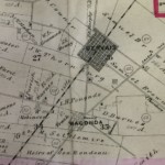
Historic town of Waconda. Map taken from the 1878 Atlas of Marion and Linn Counties Oregon. WHC
2007.072.0002
The original Waconda [Post Office] was established March 23, 1864, with John A. Foster as postmaster, and John C. Hays as last postmaster on closing November 6, 1871. The site on the Pacific highway, south of Gervais, was once a thriving village. The second Waconda [post office] was established January 26, 1912 on the Oregon Electric three miles southwest of the original Waconda. J. C. Savage was the first postmaster; closed June 15, 1926. — Payne, Edwin R. “Marion County Post-Offices” Marion County History Volume 1, 1955. Page 21.
Resources:
Read more about Old Waconda here.
1929 Metsker’s Map of Marion County (viewable on Historic Map Works) locates West Woodburn between sections 1, 2, 11 and 12 in Township 5 S, Range 2 West of the Willamette Meridian.
[Post Office] established May 14, 1912 with M.J. McCormick as postmaster; closed April 10, 1934 — Payne, Edwin R. “Marion County Post-Offices” Marion County History Volume 1, 1955. Page 21.The 1929 Metsker’s Map of Marion County (viewable on Historic Map Works) locates Willard in Section 22, Township 7 South, Range 1 West. The map shows it just south of Center View School. The place marker for Willard is at the intersection of two roads which appear to correspond (see Marion County Assessor’s Map) with the modern intersection of Cascade Highway and Sunnyview Road
[Post Office] established April 10, 1889, with Mary Starmer as postmaster; closed April 15, 1904. Payne, Edwin R. “Marion County Post-Offices” Marion County History Volume 1, 1955. Page 21. Accompanying map locates Willard as southeast of Pratum in Township 7 south, range 1 west of the Willamette Meridian.Browse Marion County Community Posts
Willamette Heritage Center Collections
Check out the WHC’s Master Indexes for names and places you are interested in.
Alpha index of people and places written about in Marion County Historical Society, Mission Mill Museum or Willamette Heritage Center created publications. Some of these publications are digitized and accessible via our website here. All publications are available at the Willamette Heritage Center research library. Some may also be available at your local library or for sale in the museum store.
Other Archives, Local Genealogical Societies and Organizations
Family History Centers
Salem Family History Center
4550 Lone Oak SE, Salem, Oregon
Oregon Historical Society
1200 SW Park Ave Portland, OR 97205, 503.222.1741
View Website – Click HERE
The Oregon Historical Society’s collections span the entire state. You can look through their catalog here.
Oregon State Archives
800 Summer St. NE Salem OR 97310
503-373-0701
View Website – Click HERE
The Oregon State Archives is the repository for all government records within the State of Oregon. You can find state records and some county records here. See a list of Marion County holdings here. Or search for a specific name here.
Polk County Historical Society
560 S Pacific HWY West Rickreall, Oregon
View Website – Click HERE
Polk County is the county directly west of Marion County. Part of the City of Salem is actually in Polk County.
Willamette Valley Genealogical Society (WVGS)
The society has trained volunteers that can help with your genealogy research. You can visit them in person during their operating hours at the Salem Public Library. They also can respond to some requests for research remotely. Check out their website for more information about hours, resources, policies, and fees.
Oregon State Police Virtual Museum
Online collections of historical materials held by the Oregon State Police. Searchable collections database
Free Digital Resources
Marion County Pioneer Cemeteries
Marion County Records on FamilySearch
FamilySearch.org has digitized a ton of Marion County, Oregon records and indexes. You can access this for free.
Oregon Historic Newspapers Database
Searchable newspaper database for Oregon papers. Marion County papers include the Aurora Observer and the Capital Journal (Salem). It should be noted that many big news stories were syndicated and sometimes will appear in other local papers of the time. Due to copyright restrictions, most of the papers will go up only through the 1920s. The papers are keyword searchable and you get to see the actual papers digitized!
Marion County (Oregon) Census Records
- 1900 US Census records for Marion County (digitized microfilm from Internet Archive)
Grow Your Research Skills

Couch Historian Web Courses
Have a computer? Stuck at home? Our Research Library and Archives mascot Maude A. Spider will teach you how to navigate the interwebs and learn more about your local history from the comfort of your own home. Hone your online research skills, learn about free web resources and learn how to spin your own histories in her weekly web episodes. Test your new skills with a skills test worksheet! Learn more about researching Mid-Willamette Valley History and the Willamette Heritage Center at www.willametteheritage.org/research.
Episodes:
Property Research
Interested in learning more about your home or property? Get started with our property history worksheets.
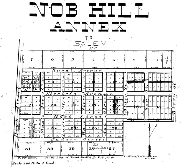
Nob Hill Annex Plat Map, 1891. Source: Marion County Survey Graphic Index.
Religious Archives
Archdiocese of Portland Archives
2838 E Burnside St Portland, Oregon
Oregon-Idaho United Methodist Church Archives
The Oregon Missions Collection (University of Puget Sound, Washington)
Queen of Angels Monastary (Mt. Angel, Oregon) History
840 S Main St Mt. Angel, Oregon
Religious Archives
Pacific Northwest Mennonite Historical Society
6030 S Whiskey Hill Rd Hubbard, Oregon