Early Marion County Government
How Marion County Got Its Name
An Island
Most Salemites have a visual image of how their county appears on the map of Oregon, – – rather like an old-fashioned key pointing east. Less familiar, however, is the fact that Marion County is virtually an island, surrounded as it is on all four sides by water. The Willamette River borders the county on the north and west; the Santiam River serves as its southern border, and the Pudding River and Butte Creek are its eastern border.
One Large County
It was not always so. In the early 1840s, when officials delineated the four districts that comprised the Oregon Country, Champoeg/Marion stretched east from the Willamette to the Great Divide and south to the California and Nevada borders. By 1853, when Washington Territory was separated from Oregon, the northern, southern, and western borders remained as they are today but, easterly, the County extended to the Rocky Mountains. Not until 1856 did Marion County acquire its present boundaries.
Name Change to Marion
Champoeg County had been renamed Marion in September of 1849 – – a total departure from the previous use of local names as the other three original districts were Clackamas, Yamhill, and Tuality. As of Oregon’s receiving Territorial status, many new counties were formed from those districts: Washington, Linn, Benton, and Polk (all of which reflected a place or person significant to Oregon’s history).
How, then to account for Marion, named in honor of a Revolutionary War hero, General Francis Marion, the legendary “Swamp Fox?” As General Marion was long gone from the American scene by that time, having died in South Carolina in 1795, and, as most of the new Oregon officials had not served with Marion’s militia troops in the Revolution at all, there must have been some other reason for his name being chosen for a county 3,000 miles away.
It is tempting to speculate that some of the earliest settlers might have been from South Carolina and urged the adoption of one of their state’s most illustrious heroes for the County name. Not so in this case, for most were Yankees from New England, New York, and points in the Northern tier of states; none had originally come from South Carolina, although there were two Southerners prominent in Oregon’s Provisional government: Georgian James O’Neil (who had provided the form for Oregon’s Constitution), and Virginian Joseph L. Meek (Oregon’s first U.S. Marshal).
There is however, the possibility that one of Oregon’s very earliest settlers actually knew of General Marion during the Revolution, William Cannon. By 1780, the main theater of action in the War had moved to the Southern colonies; Cannon, born in 1762 Virginia, would have been old enough to serve with some of the Southern militia units and, either heard firsthand of Marion’s exploits, or may have even met him on the battlefield.
Another possible explanation may be that pre-1849 settlers had come from states that already had Marion Counties, or they were familiar with counties by that name through which they had passed on their way to Oregon. In the Eastern states were 14 so-named counties, the closest to Oregon being that of Marion County, Iowa, and one Eastern county even had a Salem for its Marion County seat – – Illinois. Those Eastern states with Marion Counties in them were Alabama, Arkansas, Florida, Georgia, Illinois, Indiana, Iowa, Kentucky, Mississippi, Missouri, Ohio, South Carolina, Tennessee, and Texas. Adding Oregon, Kansas, and West Virginia later, the total is now 17.
A further logical reason behind the change from Champoeg to Marion at that particular point in time is that the latest of at least three version of General Marion’s life had been published just five years before, extolling the hero’s exploits in the War for Independence. Or, perhaps, the choice of Marion for our County’s name was simply a combination of all three of these circumstances.
County Government Organizes
Initially, County governance rested in the hands of a probate court consisting of three appointees; these first Marion County officials were Turner Crump, Benjamin Walden, and Isaac N. Gilbert (who served as clerk).
Volume I of their deliberations began in August of 1849, and recorded the matters of concern to a young county:
- settling estates,
- selecting grand jury members,
- addressing petitions for grocery and ferry licenses or for new roads,
- granting divorces,
- building bridges, and
- appointing election judges for the various precincts, as well as determining the extent of those voting precincts
Courthouse Buildings
In the absence of a Courthouse in which to hold their sessions, the Court met at the Judson-McLain house located at what is now 960 Broadway NE as well as in private houses or church buildings.. A note in the journal of their proceedings mentions paying a rent of $5 for two days’ use of the Judson-McLain house for their May term. The house was once the home of Jason Lee, and it is thought to be the second oldest building in Oregon. It was also the home of the Honorable Rueben Patrick Boise at the time of his death, April 10, 1907. This building was perhaps the very first “courthouse” was moved to its present site as a part of Mission Mill Village in Salem.
At their December 1850 session, the court designated eight precincts for the county: Champoeg, Abacaw, Northern, LaBiche, Howell Prairie, Salem, Santiam, and Mill Creek. the Justices of the Peace appointed for the various precincts were: For Champoeg, Robert Newell; for Abacaw; Samuel Allen; for Northern, James Pervine; for LaBiche, W.A. Golden; for Howell Prairie, William Greenwood; for Santiam, Thomas Holt. No justices were appointed for Salem’s and Mill Creek’s precincts as Probate Judges Crump and Walden served in that capacity for those precincts. Through the years since 1850, as the county filled with towns and new settlers, the original eight precincts have expanded now to 126. A County jail was built in 1852 at the corner of Church St. and Ferry St. the present location of DeLynn’s Cleaners, 198 Church St. NE.
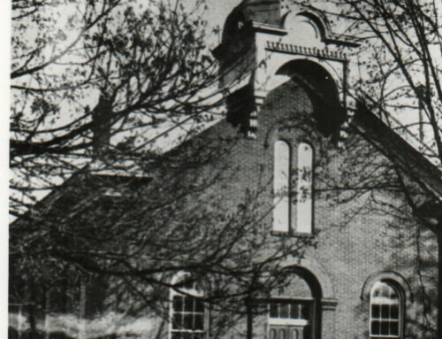
Dr. William H. Willson, an agent for the Board of the Oregon Institute (Willamette University) designated the present courthouse site “for Public purposes”. The site is located between High and Church Streets, west to east, and State and Court Streets, south to north. To Finance the construction of a courthouse, Dr. Willson even donated nine city lots to be sold at auction to help build the courthouse. The lots sold for %90 to $215 per lot. Construction began in 1853 after prizes were offered for the best design and plans. Albert W. Ferguson won the $30 prize. The total cost of construction was $15,703.93. Not until 1854, when the first Courthouse was completed, was there a site dedicated to the exclusive use of Marion County’s Court. The building was a simple, two-story frame building, 68 feet long and 40 feet wide, with four doric columns on the front and a cupola on top. It also served as the site of the Oregon Constitutional Convention of 1857, which produced the fundamental charter approved by Congress in 1859 admitting Oregon into statehood.
In the meantime, the jail located on Church and Ferry Streets was destroyed by fire, and in 1858, the County Commissioner’s Court authorized construction of a new jail for $8,000 on the courthouse block. It was a two-story brick building, 34 feet long and 25 feet wide containing three cells. Located on the southeast corner of the block, the site is now the south end of the present parking structure. This jail served its purpose until the second courthouse was built in 1873.
By 1870, it had become apparent that a new courthouse was needed to serve the county and the courts. The site selected was that of the first courthouse, so that necessitated removal of the first courthouse. Also obvious was that county and court business should not be unduly interrupted during the period of construction. An agreement was negotiated to move the old courthouse to a nearby site and restore and maintain it for interim use during construction of the new courthouse. The structure was relocated to what is now 455 Court St NE and is presently occupied by Whitlock’s Vacuum Cleaner Clinic. The buildings last use before it was dismantled was as a livery stable in 1903.
Form of Government Changes
In 1963, the Marion County Court was replaced by a Board of Commissioners. And so it continues to this day: three county commissioners with the addition of six officers:
- District Attorney,
- Assessor,
- Clerk,
- Treasurer,
- Sheriff, and
- Administrative Officer.
These are now elective, not appointive, offices. All of these officials are located in Salem for, besides being the state’s capital, Salem also serves as the County seat.
Population Served
Though one of the smaller of Oregon’s 36 counties, at 1,194 square miles, Marion ranks fifth in population. As of 1999, the County’s residents numbered 275,250 and may have reached 300,000 by now. In influence, however, it ranks first as the center of State government.
While a number of Marion County’s namesakes in the eastern United States have already celebrated their bicentennials, ours is some years in the future. However, in terms of continuous occupancy by white men, Marion County stands next only to Clatsop County and the establishment of Astoria in 1810.
An early post of the Pacific Fur Company was located in the extreme northwest of Marion County as early as 1812; it was this installation that first exposed the various fur company employees to the favorable nature of the Willamette Valley for cultivation, and assured that the first retirees from Company service would choose to settle here.
Etienne Lucier is usually credited with being the first to establish a farm on what came to be called French Prairie; that was in 1829. As he was joined by other retired Hudson’s Bay Company men and their families, the area’s viability as an agricultural center grew and became a natural magnet for the Lee mission and later settlers from the East. It was no coincidence that Oregon’s Statehood history began on the bluffs above the Willamette at Champoeg – – for that was where the greatest concentration of white settlers could be found.
By that reckoning, old Marion County could celebrate its bicentennial in just a few short years.
Written by Sue Bell – Contributed on February 4, 2003
Bibliography:
Ralph N. Preston, “Early Oregon Atlas” (Ptld: Binford & Mort, 1978) pp. 54-55.
M.V. McKeon, “General Marion, Hero of the Pioneers,’” Marion County HISTORY, Vol. 3, p. 61., p. 64.
Caroline C. Dobb, “Men of Champoeg” (Ptld: Metropolitan Press, Publishers, 1932) pp. 51 and 125.
McKeon, op. cit., p. 61.
William Gilmore Simms, “The Life of Francis Marion” (NY, 1844).
Probate Court and Count Commissioners Court Journal, Vol. I (OR Archives).
“The Courthouses of Marion County”, Historic Marion, Winter, 2001 by Richard D. Barber.
Oregon Blue Book 2001-2002, p. 259, 276.
Chester C. Kaiser, “Champoeg, The Birth Place of Oregon,” Marion County HISTORY, Vol. 2, p. 27.
Harriet D. Munnick, “Oregon’s First Farmer” Marion County HISTORY, Vol. 3, p. 9.
This article originally appeared on the original Salem Online History site and has not been updated since 2006.


Leave A Comment