It started simply enough, a visit to the Willamette Heritage Center’s research library, from two friends (and tenants) of an older home in the process of renovation. They were on a detective hunt hoping to discover the origin of the structure built in 1901 and information about past inhabitants. This just so happens to be one of our favorite research requests to help patrons with because so much can be done with a few key references, many of which are available online. You could, if you wanted, go on a detective hunt from the comfort of your favorite armchair at home.
Start with the National Register of Historic Places website in case a previous property owner has compiled all of the information you seek. For a searchable list of Oregon properties in the National Register, see the National Park Service website at nps.gov/subjects/nationalregister/database-research.
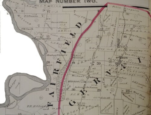
Next, settle back in your chair and make a virtual stop at the Marion County Assessor’s website, co.marion.or.us/AO. Follow the quick link provided to search individual property records. Our search quickly confirmed the 1901 build date of our home as well as current property owner information. Don’t forget to follow-up with the mapping portion of the website at co.marion.or.us/Maps. The Surveyor’s Office GIS Index System will allow you to view a history of surveys on the property site. The original survey listed for our property on July 8, 1890, contained the first real clue to the history of the land the house occupies in the form of a digitized deed and plat map.
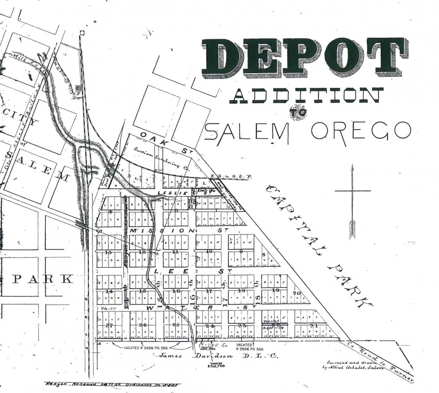
Depot Addition in City of Salem. Photo courtesy of Marion County Assessor’s website.
The deed identifies the property as part of the Original Donation Land Claim of Rev. Alvan F. Waller and wife. In 1890, the property was sold to S.R. Jessup and his wife, Sophronia. Details of the plat map show the subdivision and development plan for what would become the Depot Addition to the city of Salem.
Our next stop along the detective hunt are Sanborn Insurance Map books. With a Multnomah County library card, you can find them online at multcolib.org/resource/digital-sanborn-maps-1867-1970. Since our patrons were in our research library already, we chose to crack open the rather large, hefty map books. The Salem Public Library also has editions of the books if you want to leave the comfort of your chair and make a coffee run.
Beginning in the mid-19th century, the Sanborn Map Company of New York began issuing maps of American towns and cities to assist the fire insurance industry in establishing rates. The colorful maps depict building outlines and are color-coded to indicate structural materials. Rather than republishing the giant (24 by 26 inch) books on a yearly basis, they issued updates for map owners to paste into position throughout the book. Comparing maps over a series of years will provide clues to our specific home and the development of the neighborhood around it. We began with the 1895 book that includes updates to 1908.
According to the map, our home in 1908 was only one of two homes on the block. The structure is a wood-frame, single-family dwelling with two stories. It was built on the dividing line of two lots, and the nearest neighbor is directly to the east. In comparison to the next available Sanborn map in our series, 1927 with updates to 1957, we can observe how rapidly the neighborhood developed around our property. The home itself continues to occupy two city lots but is encroached upon by 12 additional structures on the block, including a set of apartment buildings. An additional notation on the house sketch reveals that the home is now divided up into apartments. A further puzzle also comes to light: The house number has changed.
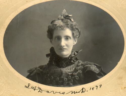
Time to bring in the big guns, the U. S. Federal Census records on Ancestry.com, which also are available at FamilySearch.org. Certain census records, including 1910, have a searchable feature for street names. Using the house numbers and street information gleaned from our maps, we should be able to narrow down the search for an early resident or occupant. Another option available to us are city directories, an early form of phone books, which also are available online. Unfortunately, these books were typically not cross-indexed by street until the 1930s and do not have an online option for searching by street name. Since we’re focused on 1900-1910, the census record and online street search option seem the better choices. And it pays off, despite differences between house numbers on the Sanborn maps and the census record itself, we are quickly able to narrow down our search to a single family, Julius and Anna Voget.
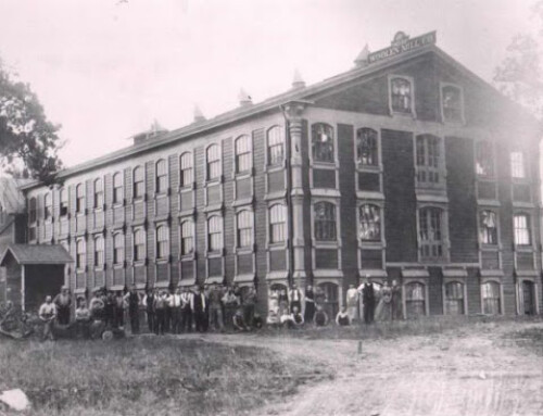
Need that coffee re-filled? Adjust your pillows and lets follow the Voget lead briefly by exploring historic newspapers available online at newspapers.com or oregonnews.uoregon.edu. Using the search parameters of 1900-1910, Salem Oregon and the name “Julius Voget,” we uncover an interesting glimpse of the man. In a Weekly Statesman article from 1903, we learn “Mr. Voget is an enterprising young German immigrant, heavily involved in land development and home building throughout the city of Salem. He and his brothers own Voget Lumber and Fuel, a lumber company and sawmill.”
So many questions still to answer. Were the Vogets the original builders of the home? Further research to narrow this down could be done by comparing three resources, the 1900 federal census, 1905 Salem city directory and the 1905 Marion County census. And who were some of the other occupants of the home, perhaps in more recent history? Federal census records and city directories could help us answer that question as well. And one last, recently available online source worth mentioning, digital images of Marion County property records. Family Search.org is slowly digitizing and making available their county record microfilm collection. Instead of a trip down to the county courthouse, we could peruse the digital pages of the old Marion County deed books to follow the line of property owners. Pretty amazing, and all from the comfort of home.
This article was written by Kaylyn F. Mabey for the Statesman Journal where it was printed 20 March 2016. It is reproduced here for reference purposes.
References:
- National Register of Historic Places – http://www.nps.gov/nr/research/
- Marion County Assessor
- 1895, 1927 Sanborn Insurance Map Books
- City Directories 1900-1910
- U.S. Federal Census Records – Salem, Marion, Oregon 1900-1940
- 1905 Marion County Census
- Ancestry.com
- FamilySearch.org
- Newspapers.com